Tree-cover loss is not deforestation
A satellite map showing lost trees does not, on its own, mean a farm breaks the EU deforestation rules. Here is the difference, and why it matters if you sell cocoa to Europe.
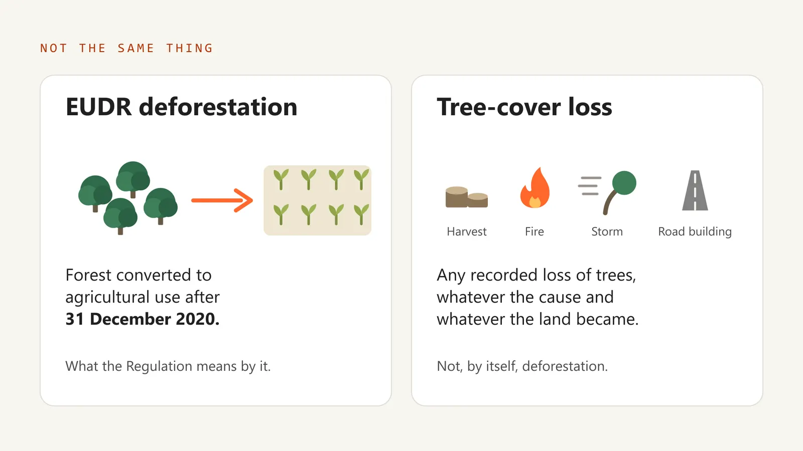
If you sell cocoa to Europe, you will hear two phrases used as if they meant the same thing: tree-cover loss and deforestation. Under the EU Deforestation Regulation, the EUDR, they do not. Mixing them up can make a farm look like a problem when it is not, or hide a gap that a buyer will still ask about.
What the Regulation means by deforestation
The EUDR is about conversion of forest to agricultural use after 31 December 2020. That date is the cut-off date.
A covered product, cocoa included, may be placed on the EU market only when three things hold at once: it is deforestation-free, it was produced in line with the law of the country where it was grown, and it is covered by a due diligence statement (or, for some micro and small primary operators, a simplified declaration).
What a tree-cover loss map records
Tree-cover loss datasets record any tree change: plantation harvest, fire, storm and road building all show up. The map sees that trees went. It does not say why, or what the land became.
So a plot can show tree-cover loss and still be deforestation-free under the Regulation. The opposite mistake happens too: a forest can be missed when a global map classifies an agroforestry landscape differently from the legal definition of forest.
What satellite evidence can and cannot answer
For a named plot, satellite data answers bounded questions well:
- Where is the submitted plot?
- What did a named forest-baseline dataset classify there at the EUDR cut-off?
- Did a named change dataset record tree-cover loss after 31 December 2020?
- Do the datasets agree, or is the result limited by coverage, definitions, cloud, spatial resolution or classification?
It cannot tell you:
- whether an observed tree-cover change was conversion of forest to agricultural use;
- whether the cocoa in a shipment actually came from that plot;
- whether every plot contributing to a mixed lot was disclosed.
A satellite evidence report belongs in the evidence file that supports the due diligence statement. It is not the statement itself.
Operators and EU competent authorities make compliance decisions. An evidence provider, ATI included, does not.
What this means for your farms
Map the actual boundary. A single GPS point identifies a location, but it does not define the boundary over which forest-loss hectares are calculated. The Regulation requires a polygon for cocoa and other non-cattle plots larger than four hectares, and ATI needs one to issue a completed satellite report.
Read loss as a question, not a verdict. If a map shows tree-cover loss on your plot after 2020, the next step is to establish what happened there: a harvest, a fire, a road, or forest cleared for farming. Of these, only forest cleared for farming is deforestation under the EUDR.
Keep the evidence together. The operator, the business that places your cocoa on the EU market, has to keep records for five years and make them available to a competent authority on request. Satellite findings, field records and supplier information all belong in that file.
To go further, read ATI's EUDR explainer, or look up any term in the glossary.
This guide summarises ATI's reviewed reading of Regulation (EU) 2023/1115. It is not legal advice. Confirm requirements against the consolidated text on EUR-Lex.